
Mountain pass · Route 1
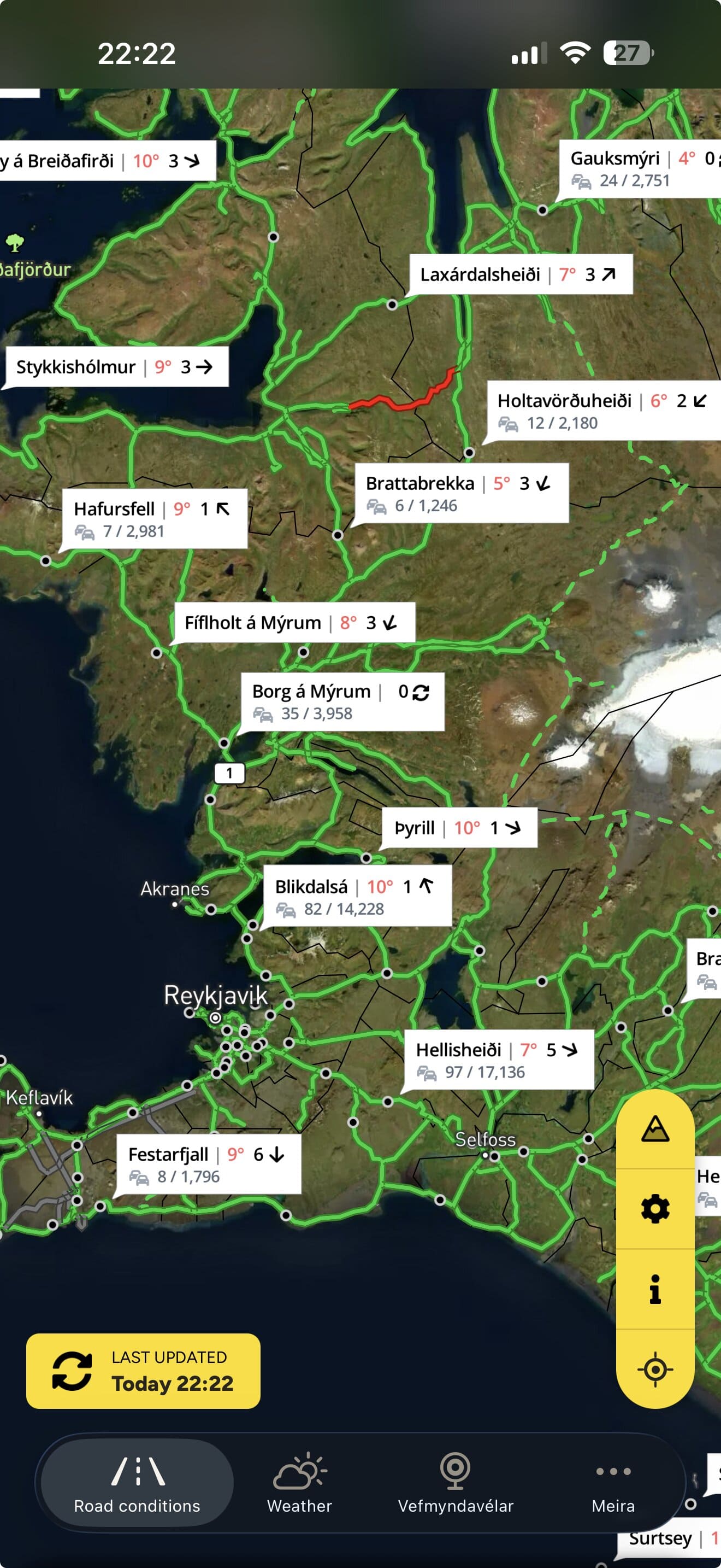
Holtavörðuheiði road conditions
Easily passable.
Assessed by Vegagerðin 02:55–05:16Checked 12:30 · Iceland time (GMT) · Monday 2 November
The pass today
- The pass
1Norðurárdalur to Hrútafjörður
Easily passable· 05:16
Show sections (1)
- HoltavörðuheiðiEasily passable· 05:16Cleared every day · Winter service: 07:30–21:30 weekdays, 08:00–21:00 weekends
- Approaches
1From Baula in the south and Staðarskáli in the north
Easily passable· 05:16
Show sections (2)
- Hringvegur. Baulan - Norðurárdalsvegur n. vegamótEasily passable· 02:55Cleared every day · Winter service: 07:30–21:30 weekdays, 08:30–21:00 weekends
- Hringvegur: Staðarskáli - HvammstangavegurEasily passable· 05:16Cleared every day · Winter service: 07:30–21:30 weekdays, 08:00–21:00 weekends
- Easily passable
- Spots of ice
- Difficult condition
- Closed
Alert me if this changes
Get a push notification when a road here changes or closes — before you leave or while you drive.
Free app. Road alerts with Premium or a Trip Pass.
Weather along the way
Vegagerðin · m/s| Station | Wind (m/s) | Gusts (m/s) | Air | Road surface | Measured |
|---|---|---|---|---|---|
| Holtavörðuheiði | SSW 19 | 25 | 7 °C | 5 °C | 12:30 |
| Kolás | S 7 | 13 | 9 °C | 7 °C | 12:30 |
| Gauksmýri | NNE 3 | 6 | 9 °C | 6 °C | 12:30 |
Holtavörðuheiði12:30
- Wind
- SSW 19
- Gusts
- 25
- Air
- 7°
- Road surface
- 5°
Kolás12:30
- Wind
- S 7
- Gusts
- 13
- Air
- 9°
- Road surface
- 7°
Gauksmýri12:30
- Wind
- NNE 3
- Gusts
- 6
- Air
- 9°
- Road surface
- 6°
Webcams

SveinatungaSveinatunga til norðursHringvegur (1) · Latest image from Vegagerðin 
SveinatungaSveinatunga niður á vegHringvegur (1) · Latest image from Vegagerðin 
SveinatungaSveinatunga niður á vegHringvegur (1) · Latest image from Vegagerðin 
KolásKolás til suðursHringvegur (1) · Latest image from Vegagerðin 
KolásKolás niður á vegHringvegur (1) · Latest image from Vegagerðin 
KolásKolás til norðursHringvegur (1) · Latest image from Vegagerðin 
HoltavörðuheiðiHoltavörðuheiði séð til norðursHringvegur (1) · Latest image from Vegagerðin 
HoltavörðuheiðiHoltavörðuheiði séð niður á vegHringvegur (1) · Latest image from Vegagerðin 
HoltavörðuheiðiHoltavörðuheiði séð til suðursHringvegur (1) · Latest image from Vegagerðin 
BrandagilBrandagil til suðursHringvegur (1) · Latest image from Vegagerðin 
BrandagilBrandagil niður á vegHringvegur (1) · Latest image from Vegagerðin 
BrandagilBrandagil til norðursHringvegur (1) · Latest image from Vegagerðin 
HeiðarsporðurHeiðarsporður séð suðurHringvegur (1) · Latest image from Vegagerðin 
Heiðarsporður Heiðarsporður séð niður á vegHringvegur (1) · Latest image from Vegagerðin 
HeiðarsporðurHeiðarsporður séð norðurHringvegur (1) · Latest image from Vegagerðin
Before you drive
Local notes from the Færð og Veður team
Holtavörðuheiði is the Ring Road between Borgarfjörður and Hrútafjörður — the main road between Reykjavík and the north. It is around 400 m high and often affected by snow and wind in winter.
Nearby
Free app
This page shows the roads now. The app tells you when they change.
Færð og Veður — Iceland Road Conditions — has the same map, webcams and weather in your pocket.
- Follow your roads. Get a push notification when a road on your route changes condition or closes. Premium or Trip Pass.
- Weather warnings from the Icelandic Met Office on the map, and as notifications with Premium.
- The whole road map with webcams and weather stations along the way.
- No account. Download and open.


Planning on a laptop? Scan to get it on your phone
Road conditions, closures, weather stations and webcams: Vegagerðin (the Icelandic Road and Coastal Administration). Weather warnings: Veðurstofa Íslands (the Icelandic Met Office). Roadinfo is independent and not run by either. A road shown as passable is not a promise that a trip is safe. Travel information can be confirmed by calling 1777. In an emergency call 112. Displayed under Vegagerðin’s terms and conditions.